OGC Collaborative Solutions & Innovation
OGC Collaborative Solutions & Innovation (COSI) is the research and development program of the OGC. In a collaborative environment between OGC staff and OGC members, it resolves all geospatial data challenges, such as training and education needs, technology challenges, policy and standards application, and guidance. OGC COSI develops the foundation for next-generation geospatial data platforms, conducts research and development initiatives on a variety of areas related to geospatial data, and assists OGC members with their local or organization-specific challenges.
OGC COSI is open to all OGC members to participate as sponsors of initiatives or as participants in initiatives. Of course, both roles can be performed simultaneously. Sponsors provide funding for initiatives and define the requirements. OGC staff translates these requirements into work items that OGC members work on as part of the collaboration.

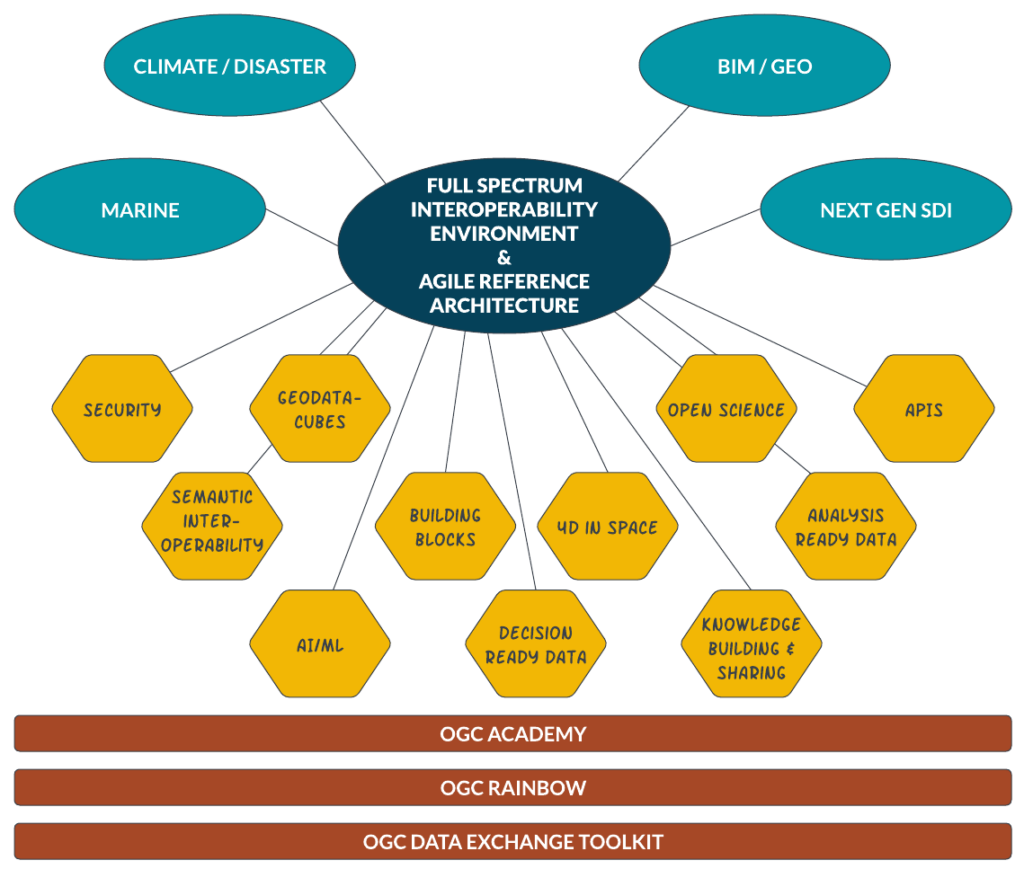
The fundamental problem of spatio-temporal data is their complexity. This arises – in contrast to many other areas – from the fact that a multitude of meaningful observations can be made about a real world object. These observations are created by different stakeholders. In detail, the different stakeholders are interested in different characteristics of the object, but in essence there is a multitude of overlaps, i.e. shared interests. It therefore makes sense to make one’s own data available, as it can be very useful to others. Often, it is only from the constellation of different views of a real-world object (and its surroundings) that the possibility for further analysis arises. Let’s take a road as an example. From the point of view of the designers of this road, parameters like subsoil, material, and structure of the road are interesting. From the point of view of a traffic planner, it is the usage data for the road, while a person from disaster management might be interested in the risk of flooding. The latter can be deduced from the data on the construction, if at the same time the data of the terrain model as well as meteorological parameters are considered. Such an analysis is not possible without the exact course that results from the contruction data. Endless examples of this kind can be found. Consequently, it is desirable to make one’s own data available to others. In doing so, various problems arise in connection with the joint use. These are summarized under the generic term “interoperability”, i.e. the ability of two machines to exchange data with each other in a meaningful and directly processable way without the need for human intervention. OGC COSI deals with a variety of interoperability problems and challenges. The individual aspects are presented in the portfolio.
Fundamental problems of data exchange on the Internet and possible solutions are discussed in the area “Next Generation Spatial Data Infrastructure (SDI)“. The OGC has probably the world’s greatest wealth of experience in the field of SDI, knows about the problems of existing SDIs and is currently developing a next generation SDI together with the Kingdom of Saudi Arabia.
Popular Posts
Recent Posts
